


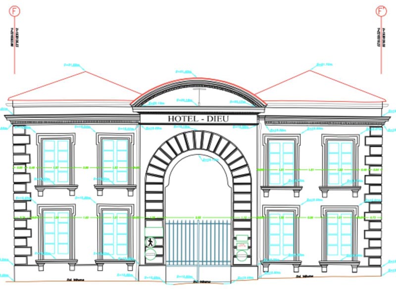
TOPOGRAPHY
General topography by total station and GPS, production of topographic plans at all scales, locations, architectural surveys (sections, elevations, facades, interior plans, etc..), advice and consulting, control and auscultations, cubatures calculation ...
LASERGRAMMETRY
3D Scanner Topography, data acquisition by static and mobile 3D scanner, topographic plans production at all scales, architectural surveys (sections, elevations, facades, interior plans, etc.), advice and consulting, control and auscultations, cubatures calculation...
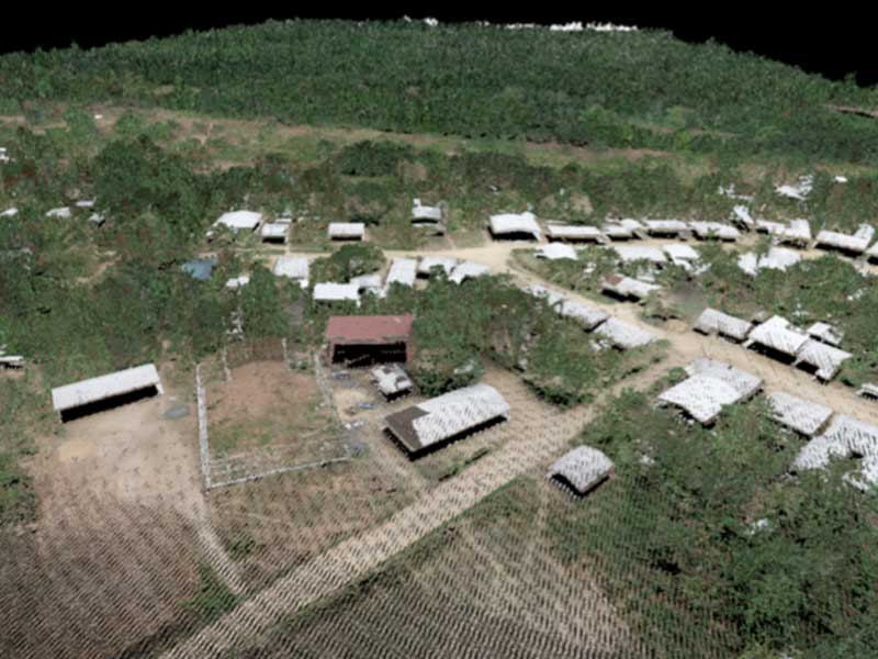
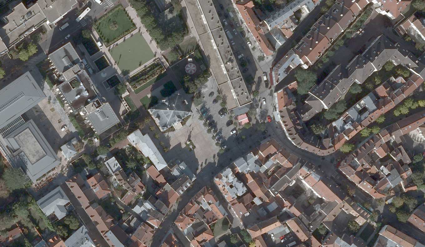
PHOTOGRAMMETRY
Aerial photography by Plane and Drone, Stereopreparation, Aero-triangulation, 3D rendering, production of topographic plans at all scales, production of digital terrain models (DTM), digital surface models (DSM), contour lines, orthophotomosaics, territorial 3D model
CARTOGRAPHY and GIS
2D digitization, Cartographic editing, Management and Optimization of Cartographic Databases, Development of GIS Applications and GeoPortals, Setting up of Geo-Web Services
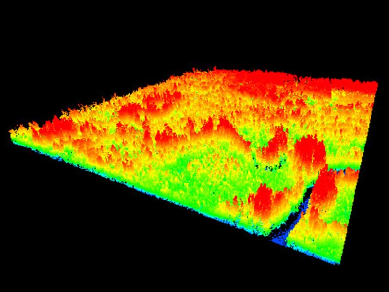
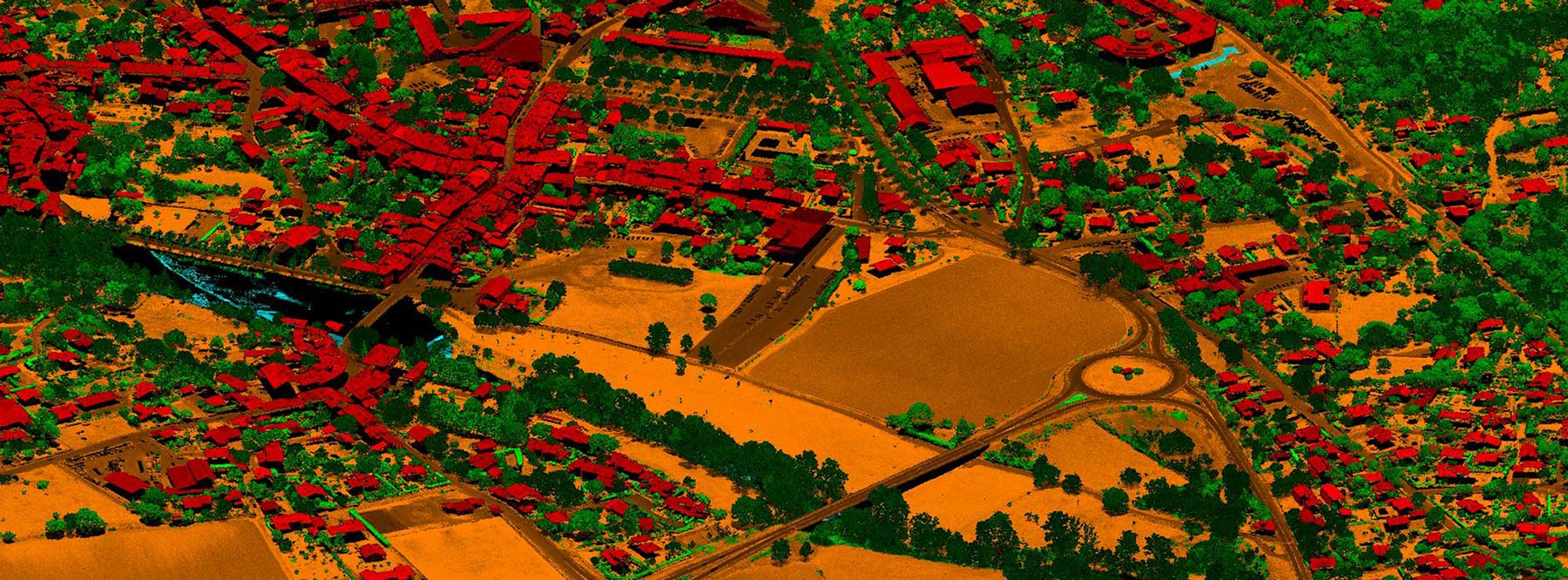
AIRBORNE LiDAR
Lidar data Acquisition by plane, Lidar point clouds Processing and classification, DTM and DMS and level curves production, realization of 3D model from Lidar data
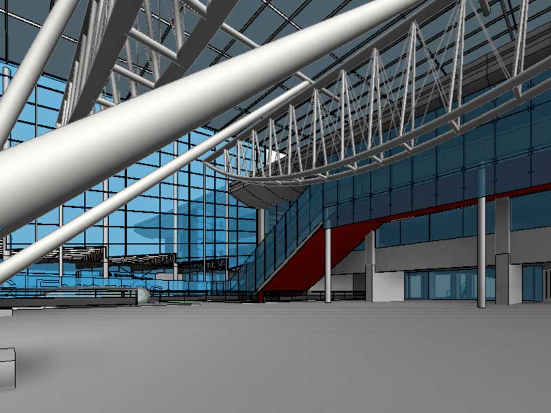
BIM (Build Information Modeling)
3D digital models production from point clouds and 3D plans
Company
Tunisian Digital Imagery Surveys is a subsidiary of STI, leaders in their field of activity. As part of its activities or of those of its parent company STI, it has provided numerous services, particularly in France (SNCF, Local authorities, EDF, Areva, ...) and abroad (in Cameroon for the National Hydrocarbons Company - SNH and the National Cartography Institute - INC, in Niger for Areva and Egis, but also in Chad, Zimbabwe, Senegal, Benin ...)
News
Long-term contract with SNCF 2023
2023
PVA in UTICA by drone: Rural centers
2024
PVA in KORBA by drone: Rural centers
2024
PVA in Nabeul by drone: A 500 ha project in the city
2024
Implementation of Quality Management System (QMS)
2024
Birth of TDIS
02/2014
Aerial Photography in Sfax : Port and Airport
06/2017
Arrival of the DJI Matrice 100 in Tunisia
12/2017
Aerial Photography by Drone : All commercial ports of Tunisia
03/2018
TDIS becomes Expert Surveyor
04/2018
Aerial Photography by Drone : Wind farm of South Bizerte
06/2019
Arrival of the DJI Phantom4 Pro drone in Tunisia
07/2020
Aerial Photography in Nabeul : Dam El Masri
07/2020
Aerial Photography by Drone : Agricultural site of Jradou
08/2020
Services
Since its creation, TDIS has specialized in aerial and terrestrial topographic surveying, and has mastered all aerial photography techniques, from photogrammetry to lasergrammetry, including digital cartography. In the field of geomatics, our team supports public and private stakeholders on all types of projects: road works, development studies, urban planning ...
Topographic data by airborne lidar
Production of topographic data by airborne lidar for road, electrical, railway, urban projects: classification of high density point clouds, Digital Terrain Models (DTM), Digital Elevation Models (DEM), contour lines, derivatives (longitudinal and cross sections, 3D modeling of buildings, power lines, pipelines, topographic plans by lasergrammetric interpretation, etc.)
Topographic data by photogrammetry
Production of topographic data by airborne photogrammetric method for road, electrical, railway, or site layout projects: topographic plans at all scales (1 / 500th, 1 / 1000th, 1 / 2000th, 1 / 5000th, 1 / 10,000th), 3D rendering, Digital Elevation Models (DEM), Digital Surface Models (DSM), orthophotoplans, 3D building modeling
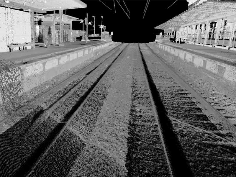
3D scanner survey
Dynamic terrestrial 3D scanner (mobile), rail on trolley, lorry type rail: dynamic acquisition of a very high precision and very high density cloud of points, elaboration from the cloud of points of conventional or 3D railway surveys, REGEVOIE or TopoRAIL surveys of the structure of catenaries, switches and crossings, tunnels, 3D modeling type BIM under Autodesk Revit, etc....
Mapping for the development of airport and port infrastructure
Topographic and cartographic products for the planning and development of airport and port infrastructures: ground plans by aerial photogrammetric method, orthophotographs, Digital Terrain Models, aerial obstacle surveys and airport mapping according to ICAO standards (eTOD, AMDB, etc), Geographic Information Systems (GIS)
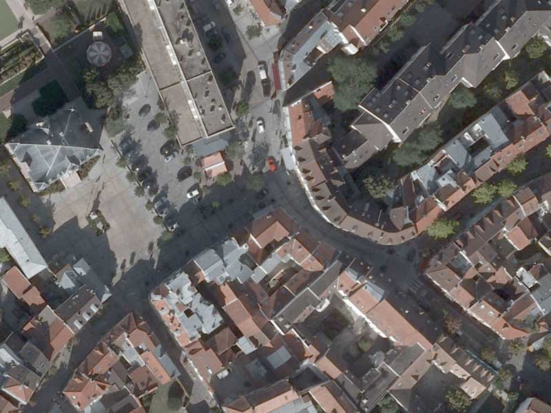
Mapping for cadastral purposes
Topographic and cartographic products for local land-use planning and development and for cadastral needs: 2D and 3D city plans (1 / 1000th, 1 / 2000th, 1 / 5000th), high and very high resolution urban orthophotographs, Digital Terrain Models, implementation of Urban Geographic Information Systems (GIS), mobile 3D scanner surveys (mobile mapping), national geodetic networks.
Mapping for land use planning
Topographic and cartographic products for national or regional planning and development: 2D and 3D cartography at 1:25000, 1:50000, 1:200000 and 1:500000 scale, Digital Terrain Models and orthophotographs from aerial or satellite images on a national or regional scale.
3D Modeling
3D modeling by Autocad or BIM (Autodesk Revit) by acquisition and processing of static or mobile terrestrial 3D scanner for buildings, networks and pipes (gas, oil, etc.)
3D urban models
Urban 3D models by photogrammetry and LIDAR: management in ArcGIS / ArcSCENE of 3D models and attribute data
Some References
- All
- Topography
- Photogrammetry
- Lidar
- 3D Scan
- Cartography & GIS
- WebMapping
- BIM


Some Clients


Equipments
To carry out our services, we also have the technical support and equipment of our parent company STI.

Piper PA-31T2 Cheyenne

Optech ALTM Orion H300 Lidar

Vexcel Ultracam Xp Camera

DJI Matrice 100 Drone

Phantom 4 RTK Drone

3D Scanner

Leica Total Station

Photogrammetric Station
Partnership
Stealth International LLC
TDIS is the official representative of Stealth International LLC in Tunisia